Laden...
United States

Regional Airports

1 STARS

TearWearDesigns - KEZMv2 1.0.0

Hello everyone! First off... HAPPY NEW YEAR! I know it has been ages since I last done anything. Life has really been getting in the way and I haven't really been focusing to much on the freeware side of things. Anyways, nonsense aside, I am...

Über

Hello everyone! First off... HAPPY NEW YEAR!

I know it has been ages since I last done anything. Life has really been getting in the way and I haven't really been focusing to much on the freeware side of things.

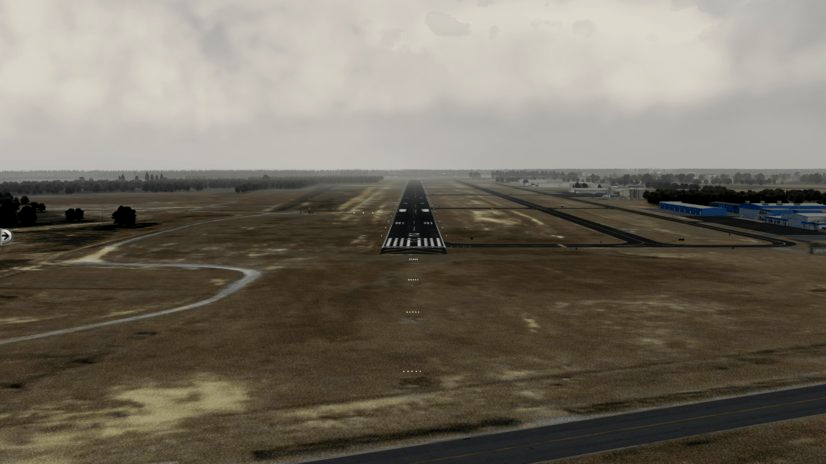
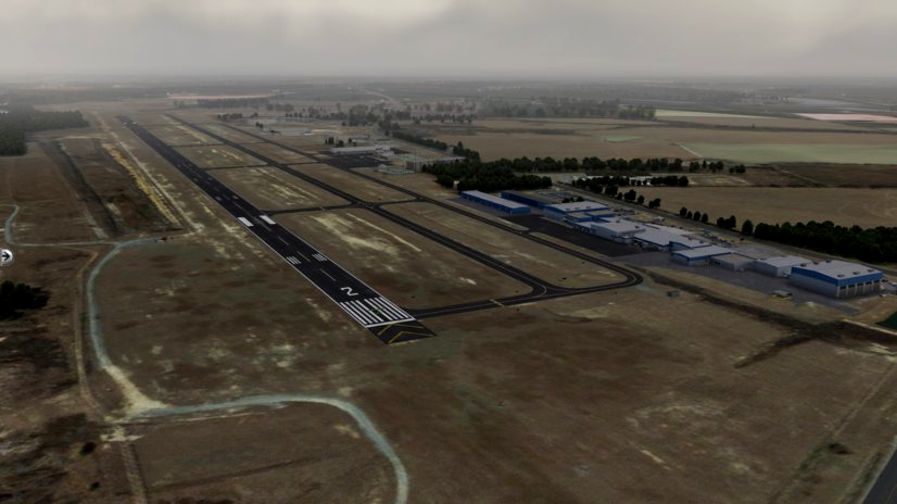
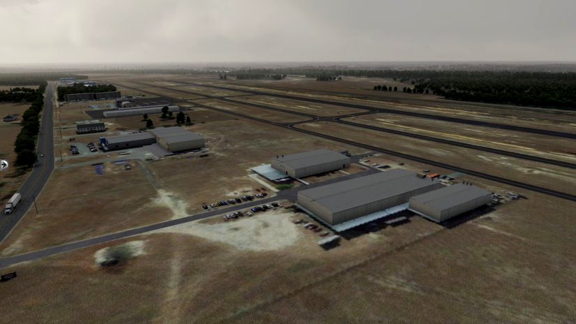
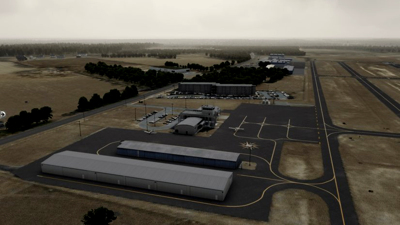
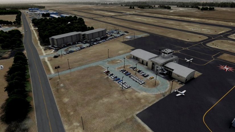
Anyways, nonsense aside, I am proud to bring you V2 of our KEZM scenery. This new version includes MANY new features. Such as, new taxiway lines, new taxiway markings, better taxi sign placing, better detail in surrounding area, added animals, added ortho, added betters cars, gave a little "easter egg" somewhere.. see if you can find it... 

Anyways, so, this airport was definitely one of my most favorites to make. It is such a simplisitic airport to make and such a easy airport to look at. The airport is so easy to get around and it's actually a college! 

This airport is home to "Middle Georgia State University" that offers all of your license you need, such as private, instrument rating, commercial, CFI, CF-II, tailwheel, aerobatics, upset recovery, multi-engine, MEI and they even offer helis! This scenery was something that I just kinda messed with on the side and didn't really wanna take to much time on it, but I spent more time on it than what I was hoping! 


Anyways, thank you everyone for all the love and support and I can't wait to see you guys in the next one. 
Discord: https://discord.gg/mcNfYQD9

Required Libraries: 

MisterX 

CDB 

ALES

Let me know if there is more! Please. Thank you. 


Installation: 

1. Open the file 

2. Click "TearWearDesigns - KEZM" 

3. Find the same one again

4. Drag that folder to the "custom scenery" folder in your main X-Plane directory 

5. Load sim and enjoy 


Feel free to contact me for questions and inquiries. 

[email protected]

Details
Kompatibilität
Erstveröffentlichung
January 01, 2023
Zuletzt aktualisiert
1 year(s) ago — 1.0

Version

1.0

Dateigröße

208.96 MB

Downloads

144

Diese Datei wurde auf Viren gescannt und ist sicher zum Download.

Datei Informationen

Abonnenten
4
Bewertung
1/5.0 — Schlecht
Status
Noch nicht heruntergeladen
Heutige Downloads
0

Schlecht
Basierend auf 1 Bewertungen
😢
0
traurig
😠
0
wütend
😮
0
schockiert
🙏
0
Dankbar
😂
0
amüsiert
😍
0
verliebt

Timeline

  • Initial File Release


Berechtigungen

Upload-Erlaubnis
Es ist unter keinen Umständen erlaubt, diese Datei auf andere Seiten hochzuladen.

Änderungserlaubnis
Sie dürfen meine Datei unter keinen Umständen verändern oder verbessern.

Umwandlungserlaubnis
Sie dürfen diese Datei unter keinen Umständen konvertieren.

Asset-Nutzungserlaubnis
Es ist Ihnen unter keinen Umständen erlaubt, Assets aus meiner Datei zu verwenden.

© TearWearDesigns - All rights reserved. Jeglicher Re-Upload oder Weitervertrieb dieser Datei ohne vorherige schriftliche Zustimmung des Autors ist untersagt. Diese Flight Simulator 2020 Mod wurde erstellt von TearWearDesigns and shared in Scenery Enhancements » Regional Airports für X-Plane 12.


3 Kommentare

Please list all the libraries required next time! It needed OpenSceneryX AND HandyObjects library! The scenery does not load anything even with the libraries required!


Roadmap
Diese Artikel befinden sich derzeit auf der Liste und werden in Kürze bearbeitet!
Backlog
Vorschläge, Bugs und Ideen für die Zukunft.

  • Veröffentlicht January 01, 2023

    Die erste Version dieser Datei wurde gerade veröffentlicht. Willkommen an Bord!

Häufig Gefragt

Fragen? Finden Sie hier Ihre Lösung.


Ziemlich leer hier drüben.

Spenden

Diese Benutzer haben gespendet an TearWearDesigns damit er weiterhin fantastische Add-ons für jedermann herstellen kann.

Abhängigkeiten

These add-ons may be required or recommended to use.


Ziemlich leer hier drüben.


Google Maps Import

Parts of this content includes 3D data and textures copyrighted by « Google Map data ». Google Maps and Map data are provided by © Google, LLC, Mountain View, California, US. This free creation contains content from Google Maps or Google Earth, in accordance with Google Terms of Services and especially point 2.2 of Google Maps/Google Earth Additional Terms of Service. This creation is based on « fair use » or « fair dealing » of the data provided by Google through its services. No commercial use or any gain will be made by the author of this creation or the original host site, who use Google assets as provided for by the simple user licence. The author is freely sharing a creative application of Google Maps or Google Earth. The author will not receive any form of remuneration for sharing this work. Spontaneous general donations from users of file hosting web services under the form of « rewards » or « tips » will be rejected. If this content is found elsewhere and is offered in exchange of money or any other kind of remuneration, it is without the permission of the author and if such theft of intellectual property occurs, this site, and the author will disavow such distribution. Google has stated that it cannot answer to any direct demand about a particular creative use of its properties, as it stated in the « written permission » paragraph of the same document, and all such demands should in the first instance be directed to the author of this work. The author’s verification of compliance with Google’s Terms of Services will rest on this statement of intent, and the use of the provision of the « Fair use » paragraph of the document. As it is economically unreasonable for the casual creator of this content to ask for a costly legal analysis of its creation like proposed in the « Fair use » paragraph of the document, the author of this creation and the owners of this site undertake to destroy any trace of the work on first demand from Google, in accordance with the paragraph « Taking action in case of problems » of the Google Terms of Service about « advance notice » provided « when reasonably possible ».